Sunday, September 28, 2014

Week of Sept. 29
Image showing approximate number of satellites and space junk orbiting around the Earth.


Questions to consider:


1.  What are at least 3 examples of information that can be gathered from remote-sensing images?
2.  What is GPS and how does it work?
3.  What is GIS used for?
4.  How can remote-sensing images show how land features change over time?
5.  Can you identify some basic landforms shown in satellite images?

Observing Antarctica

Aerial Images of Erosional Landforms


Changing Erosional Landforms in Satellite Images

Petermann Glacier in Northern Greenland - compare and contrast the before and after images of the glacier.

California 2013-2014 - compare and contrast the before and after images of California.

Identifying Landforms

Satellite image of red volcano surrounded by green land.
Volcano - Mt. Fuji in Japan

The Himalayan Mountain Range

Alluvial Fan in China
The Nile River
The Great Lakes
Lena River Delta, Russia – The delta is frozen tundra for about seven months of the year, and spring transforms the region into a lush wetland. Photo: Boyd, John, Source: "Earth As Art," Published By NASA\
Wetland in Russia
Namib Desert, Namibia – Here, southwest winds have created the tallest sand dunes in the world, with some dunes reaching 300 meters in height. Photo: Boyd, John, Source: "Earth As Art," Published By NASA
The Great Sahara Desert! Some of those sand dunes are over 300 feet tall!
Green River, Desolation Canyon, Utah – Desolation Canyon is one of the largest unprotected wilderness areas in the American West. Photo: Boyd, John, Source: "Earth As Art," Published By NASA
Green River and Desolation Canyon, Utah

Sunday, September 14, 2014

Week of Sept. 15
What you are looking at is a 3-D image of Glacier National Park with a topographic overlay.  A what?

Questions to consider:

1.  What are the differences between geological maps, topographic maps, aerial photographs, satellite images, and physical maps?
2.  What is topography?
3.  What does a topographic map show?
4.  What is the difference between relief and slope of the land?
5.  How do you use contour lines to find the contour interval?
6.  How can a topographic map help you identify landforms?

Types of maps:

Geological Map - show rock types and ages


Physical Map - shows land features


Topographic Map - shows the shape of the Earth's surface with lines that represent elevation

Satellite Images and aerial photography

Mississippi River Delta
O
Satellite Image - taken from orbiting satellite in space

Color Interpretation:  dark blue/black = ocean water, light blue - sediment and shallow waters, red (false-color) = vegetation

Aerial Photography - taken from somewhere in the atmosphere

Topo Activity 1


Directions:  Match the landform letters to its topo map numbers!


Topo Activity 1

Directions:  What is the contour interval of this topo map section? (Units will be in feet)

Sunday, September 7, 2014

Week of Sept. 8, 2014
Erosion and Deposition by wind, ice, and gravity


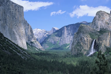
Yosemite Valley - created by a glacier

Questions to consider:

1.  What is abrasion?  What conditions are necessary to create abraded rock?
2.  How does a sand dune form?
3.  What is loess? Why is it valuable?
4.  How does a desert pavement form?
5.  What are the 2 types of glaciers?
6.  How do glaciers change the shape and makeup of the land? 
7.  What are some examples of glacial landforms?
8.  What is mass movement?
9.  What are the types of mass movement (wasting)?
10.  What events can cause mass movement (wasting)?


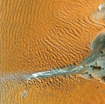
Wind Erosion Examples

Classic Sand Dune - Why do sand dunes have a gentle slope and a steep sloop?  Hint: What direction is the wind blowing from?
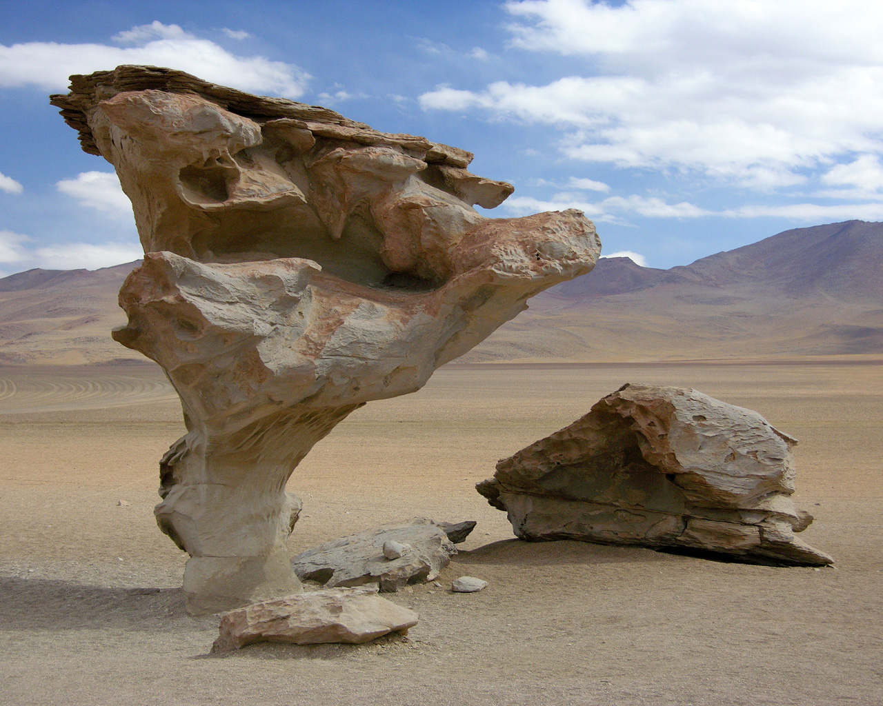
Abrasion of rock is the most extreme lower to the ground - how can you tell?
The Wave in Arizona - how do you think this landform was created?


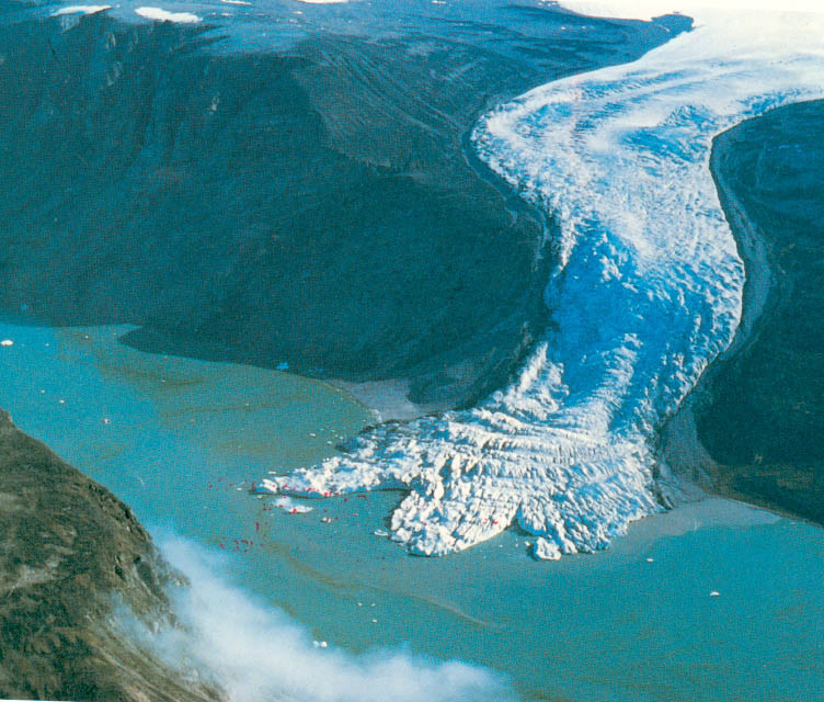
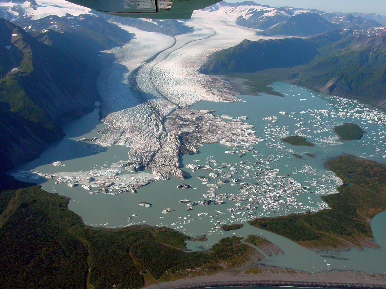
Ice! Ice! Baby! Continental vs. Alpine Glaciers


Erosion and deposition by glacier!

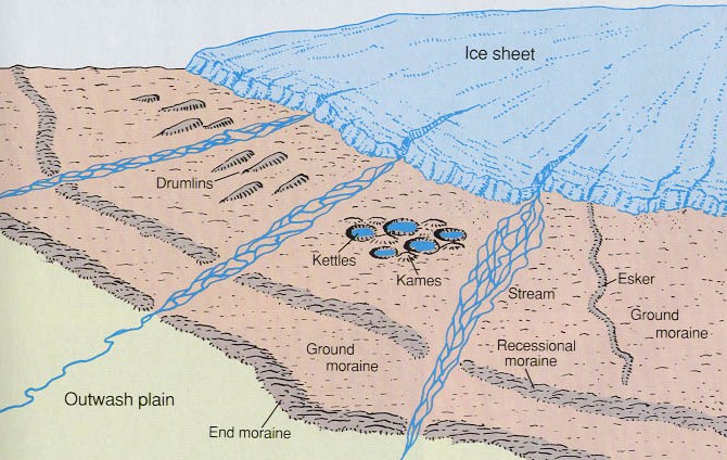
Continental Glacial Landforms 


Erratic - large rocks/boulders deposited by glaciers

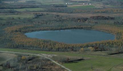
Kettle Lake - forms when glacial ice melts

Esker - long, winding ridge of sand and gravel

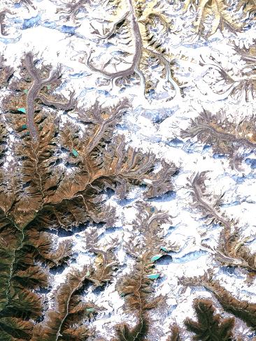
Alpine Glaciers - in the mountains!

Glacial V-Shaped Valley
Moraine  - is material eroded and deposited by a glacier.  There are 8 different types of moraine - the above picture shows glacial till running down the middle of the glacier.

Glacial Outwash - sediments deposited by meltwater

Glacial Till - random assortment of sediment

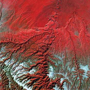
Ohio's History with Glaciers
Ohio approximately 24,000 years ago! Continental glaciers moved over Ohio 4 times creating the Great Lakes and the Ohio River.  The soil left behind by the glacier was very rich - great for crop growing.  The southern part of Ohio was never covered by glaciers - the landscape is more hilly while the area of Ohio covered by glaciers is flat.

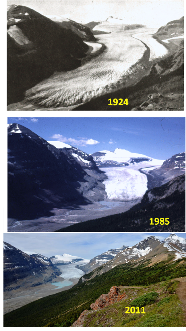
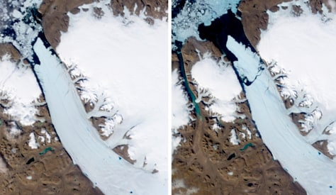
Melting Glaciers  - climate change and glaciers

Glacier National Park


Greenland Ice Sheet

Mass Movement (Mass Wasting) - shifting of materials due to force of gravity, and erosional forces, (heavy rains, deforestation, unstable slopes, earthquakes, volcanic eruptions).

Fast


Slow - Creep


Notice how the eroded hillside has forced the trees to creep - amazing!

Monday, September 1, 2014


Science - Week of Sept. 2

Sinkhole in Florida

Really extreme erosion! How do think sinkholes form?

Questions to consider:

1.  What is the difference between erosion and deposition?
2.  What are the 4 agents of erosion and deposition?
3.  What conditions produce faster erosion in streams?
4.  What conditions produce faster deposition in streams?
5.  What are the major landforms created by erosion and deposition in streams?
6. What are the major landforms created by groundwater?
7.  What are the major coastal landforms created by erosion and deposition?

More examples of erosion and deposition:


Grand Canyon
Sahara Desert
Mars

Bryce Canyon, Utah
Indonesian Cave

Bay of Fundy Canada
Video: